
Download Picmeta PhotoTracker – geotagging, GPS, photo tracking, digital camera, image metadata, EXIF, travel memory, photo archive, location tagging, smartphone
Overview
Picmeta PhotoTracker is a free utility designed to bridge the gap between digital photography and geographic data. By integrating GPS information from external devices or smartphones, it automatically embeds location metadata into the EXIF fields of digital images. This functionality enables users to tag their photos with precise geographic coordinates, making it easier to track where each image was captured. The app is particularly valuable for travelers, photographers, and outdoor enthusiasts who rely on visual documentation of locations for personal or professional purposes.
It addresses a common challenge in photography: the loss of spatial context over time. Without geotagging, photos may become disconnected from their original locations, making it difficult to recall or revisit memorable spots. Picmeta PhotoTracker solves this by preserving the geographic history of images, allowing users to rediscover places during future trips or simply relive moments with greater accuracy. The app supports a broad range of image formats, including JPEG, TIFF, NEF, RAW, CRW, and DNG, making it adaptable to both casual users and professionals working with high-end camera systems.
Developed by Picmeta, the app has been available since 2014, indicating a stable and mature product with a focus on core functionality. While specific details about the company’s background are not provided, the app’s longevity suggests consistent development and user trust. It fits within the broader productivity and utility category of mobile apps, offering a specialized tool that enhances the value of digital photography through metadata enrichment.
Key Features & Functionality
- Automatic Geotagging: The app seamlessly links GPS data from connected devices or smartphone location services to photos. As images are processed, location coordinates are embedded into the EXIF metadata without requiring manual input, saving time and reducing user error.
- Multiple Format Support: Picmeta PhotoTracker handles a wide variety of image formats, including common ones like JPEG and TIFF, as well as professional-grade formats such as NEF, RAW, CRW, and DNG. This ensures compatibility across different camera systems and workflows.
- EXIFcare Technology: A core feature of the app is its use of EXIFcare technology, which preserves existing metadata such as EXIF, IPTC, and Makernote fields. This means that while GPS data is added, no original image information is overwritten or lost.
- Travel Memory Aiding: By recording the geographic location of each photo, the app helps users create a personal, location-based photo archive. This supports memory recall and enhances the storytelling potential of visual content over time.
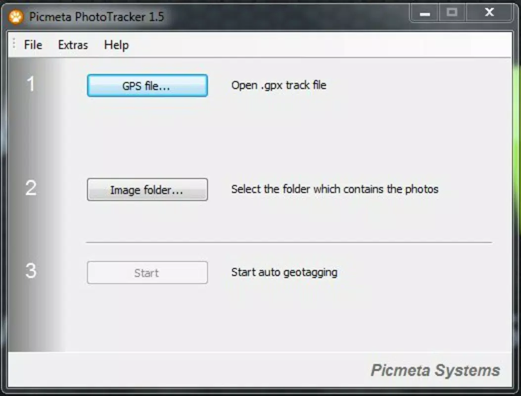
- User-Friendly Interface: Designed with accessibility in mind, the interface allows users to initiate geotagging with minimal steps. Even those without technical expertise can navigate the app and achieve accurate results.
For example, a traveler using a DSLR camera can pair their device with a GPS logger, run Picmeta PhotoTracker on their Android phone, and automatically tag all captured images with location data. Similarly, a nature photographer documenting remote landscapes can use the app to maintain a detailed log of where each shot was taken, aiding future research or revisits.
Interface, UX & Performance
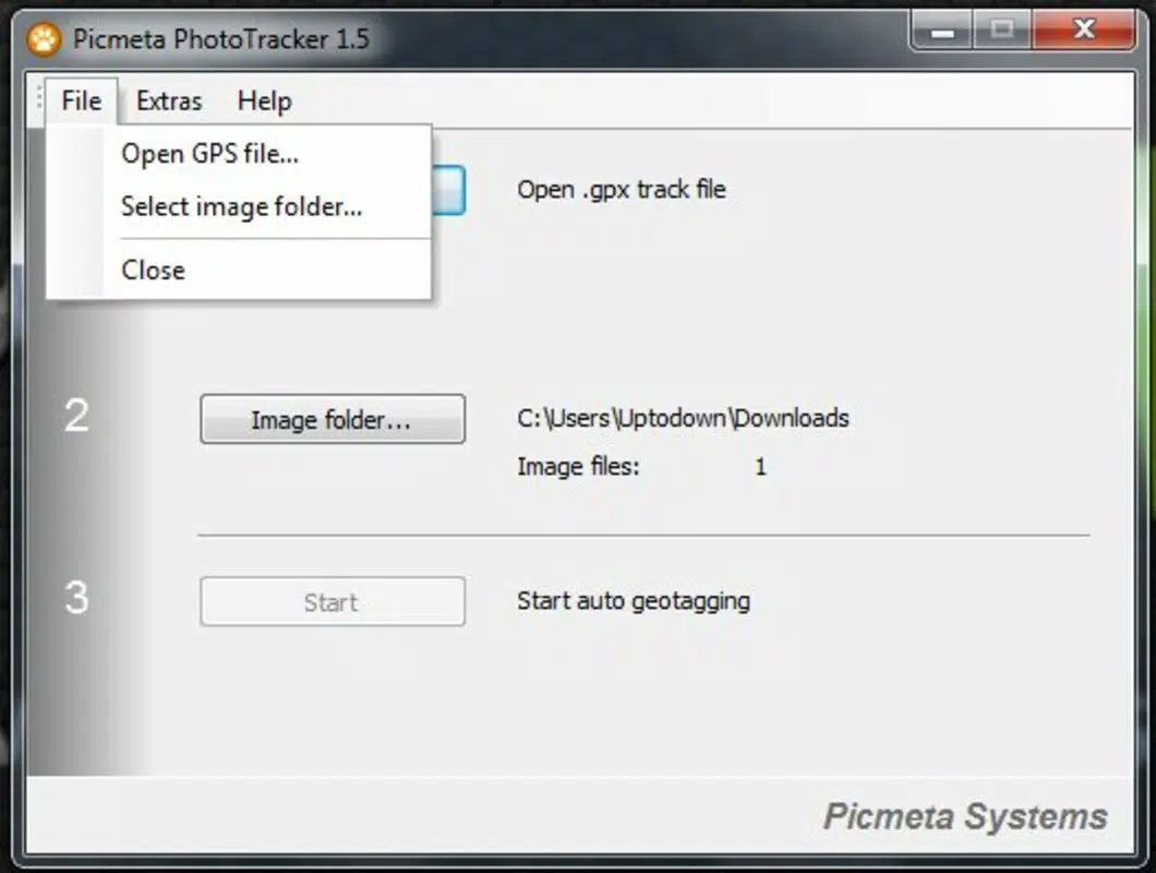
The user interface of Picmeta PhotoTracker is designed to prioritize clarity and simplicity. Navigation is linear and intuitive, guiding users through the geotagging process with minimal friction. The layout emphasizes essential controls, such as file selection, GPS synchronization, and processing options, ensuring that users can complete tasks efficiently.
Visual design elements are functional rather than ornamental, focusing on readability and task-oriented workflows. Buttons are clearly labeled, and feedback is provided during processing, such as progress indicators and success notifications. The app maintains responsiveness across different screen sizes and device types, though specific performance benchmarks were not disclosed.
Although the developer did not list formal performance metrics, the app’s lightweight nature—only 15.7 MB in size—suggests optimized resource usage. It is likely to run smoothly on mid-range Android devices, with minimal impact on battery or memory. Stability appears consistent, given the app’s long-standing presence in the market and its focus on a single, well-defined function.
Platform Compatibility & Technical Requirements
Picmeta PhotoTracker is available exclusively on the Android platform. It requires Android OS, though specific minimum version requirements were not listed. The app’s file size is 15.7 MB, indicating a compact footprint that should be compatible with most modern smartphones.
While the developer did not specify exact compatibility details, the app’s reliance on GPS functionality and file system access suggests it operates on devices with standard Android capabilities. Users should ensure their device supports external GPS input if using a dedicated GPS logger. The app does not appear to require root access or special permissions beyond standard storage and location access.
Pros and Cons
Pros
- Free to download and use, making it accessible to a wide audience.
- Supports a broad range of image formats, including professional RAW and DNG files.
- Preserves original metadata using EXIFcare technology, ensuring data integrity.
- Automatically geotags photos, reducing manual effort and potential errors.
- Simple, intuitive interface suitable for non-technical users.
Cons
- Platform availability is limited to Android; no iOS version was mentioned.
- Specific OS version requirements were not disclosed.
- Advanced geotagging features may require external GPS hardware.
- Developer did not provide detailed update history or changelog.
- Compatibility with certain camera models or file types was not verified.
FAQ
Is Picmeta PhotoTracker safe to install?
Yes, the app is free and available through official Android channels. It requests standard permissions such as access to storage and location, which are necessary for geotagging. No third-party data collection was mentioned in the provided information.
Can I use Picmeta PhotoTracker without a GPS device?
Yes, the app can utilize the smartphone’s built-in GPS to geotag photos. However, for more accurate or continuous tracking, especially during extended shoots, an external GPS logger is recommended.
Does the app work with RAW and professional image formats?
Yes, Picmeta PhotoTracker supports multiple formats including RAW, NEF, CRW, DNG, TIFF, and JPEG, making it suitable for both amateur and professional photographers.
Will my original photo metadata be lost?
No. The app uses EXIFcare technology to preserve existing metadata such as EXIF, IPTC, and Makernote data. Only GPS coordinates are added, ensuring no data loss.
How often does the app receive updates?
The developer did not provide information about update frequency. However, the app has been available since 2014, suggesting ongoing maintenance and support.
Final Thoughts
Picmeta PhotoTracker stands out as a reliable, no-frills solution for anyone seeking to enrich their digital photos with geographic context. Its ability to automatically geotag images across multiple formats—without compromising original metadata—makes it a valuable tool for travelers, photographers, and memory keepers alike. While limited to Android and lacking detailed technical disclosures, the app delivers consistent performance and a clean user experience.
For users who value location-based organization of their photo libraries, this app offers a practical way to build a personal travel archive. It transforms static images into dynamic records of place and time, enhancing both personal storytelling and professional documentation.
Download Picmeta PhotoTracker now


